
Keyword
Research Voyage: IN2017_V01
15 record(s)
Type of resources
Topics
Keywords
Contact for the resource
Provided by
Formats
Update frequencies
Status
draft
-
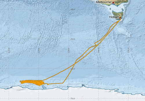
This record describes multibeam echosounder data collected on RV Investigator voyage IN2017_V01, 'Interactions of the Totten Glacier with the Southern Ocean through multiple cycles. ‘Sabrina Seafloor Survey' which departed Hobart on the 14th January 2017 and returned to Hobart on the 5th March 2017. The Kongsberg EM710 MKII multibeam echosounder was used to acquire seafloor bathymetry and backscatter information between Hobart and Totten Glacier. The EM710 MKII provides a 0.5° by 1° transmit and receive angular resolution respectively. The echosounder's nominal frequency range is from 40 to 100 kHz. Data are stored in *.all raw format for bathymetry and backscatter and *.wcd format for watercolumn backscatter at CSIRO. There are 71 files totalling 12 GB of raw data in this dataset. Sound velocity profiles were applied to this data during data acquisition. Bathymetry data contained in *.all format are corrected for motion and position. Tide corrections were not applied to the processed data. Processed data has had outliers removed. Processed line data are available in *.gsf and ascii format, and processed bathymetry and backscatter grids in geotiff format. Additional information regarding this dataset, including further information on processing streams, is contained in the GSM data acquisition and processing report. Additional data products may be available on request.
-

This record describes the deep-sea sediment core products produced by Holder et al. (2020) from two sites in the Sabrina Coast continental slope and rise, the first sedimentary sequences investigated in this region of the East Antarctic. The cores were used to study changes in the oceanic and depositional environment and their interaction with the nearby Totten Glacier. The two archives show clear variations between glacial and interglacial phases over the last 350 Kyrs, driven by the movement of the ice sheet advancing and retreating over the continental shelf and ocean circulation patterns that deliver heat either close to the Antarctic coastline or further away from the continental slope. This research provided a foundation for future palaeoceanographic work in the region and suggested that warm oceanic conditions, similar to today, have influenced the Sabrina Coast during past warm interglacials over the last 350 Kyrs. For more details please refer to the cited article (download link provided below): Holder, L., M. Duffy, B. Opdyke, A. Leventer, A. Post, P. O’Brien and L. K. Armand (2020): Controls on Sedimentation and Primary Productivity in Late Pleistocene Slope Sediments Seaward of the Totten Glacier, East Antarctica. Paleoceanography, under review.
-
This record describes multibeam echosounder data collected on RV Investigator voyage IN2017_V01, 'Interactions of the Totten Glacier with the Southern Ocean through multiple cycles. ‘Sabrina Seafloor Survey' which departed Hobart on the 14th January 2017 and returned to Hobart on the 5th March 2017. The Kongsberg EM122 multibeam echosounder was used to acquire seafloor bathymetry, backscatter information between Hobart and Totten Glacier. The EM122 provides a 1 degree by 1 degree angular resolution. The echosounder's nominal frequency is 12 kHz. Data are stored in *.all raw format for bathymetry and backscatter and *.wcd format for watercolumn backscatter at CSIRO. There are 1310 files totalling 32.9 GB of raw data in this dataset. Sound velocity profiles were applied to this data during data acquisition. Bathymetry data contained in *.all format are corrected for motion and position. Tide corrections were not applied to the processed data. Processed data had outliers removed. Processed line data are available in *.gsf and ascii format, and processed bathymetry and backscatter grids in geotiff format. Additional information regarding this dataset, including information on processing streams, is contained in the GSM data acquisition and processing report. Additional data products may be available on request.
-
This record describes scientific split-beam echosounder data collected on the RV Investigator voyage IN2017_V01, 'Interactions of the Totten Glacier with the Southern Ocean through multiple cycles. ‘Sabrina Seafloor Survey' which departed Hobart on the 14th January 2017 and returned to Hobart on the 5th March 2017. The Simrad EK60 split beam echosounders 18, 38, 70 120, 200 and 333 kHz were used to acquire acoustic backscatter data to a range of 1500 m, between Hobart and Totten Glacier. All frequencies were logged continuously for the extent of the voyage. Data are stored in *.raw, *.bot and *.idx format at CSIRO. There are 1120 files totalling 31.5 GB of raw data in this dataset. No processing has been conducted on this data. Additional information regarding this dataset is contained in the GSM data acquisition and processing report. Additional data products may be available on request.
-
This record describes sub bottom profiler data collected on RV Investigator voyage IN2017_V01, 'Interactions of the Totten Glacier with the Southern Ocean through multiple cycles. ‘Sabrina Seafloor Survey' which departed Hobart on the 14th January 2017 and returned to Hobart on the 5th March 2017. The Kongsberg SBP120 (sub bottom profiler) was used to acquire data containing the specular reflections at different sediment interfaces below the seafloor. The SBP120 provides a 3° by 3° angular resolution. The echosounder's frequency sweep range is from 2.5 to 7 kHz. The SBP120 was logged continuously for the extent of the voyage. Data are stored in *.raw (381 files 5.81 GB) raw and *.seg (220 files 3.62 GB) segy formats at CSIRO. The segy format data had a real time processing stream applied, which applies gain, a gain correction, matched filter with replica shaping, an attribute calculation for instantaneous amplitude and time variable gain. Additional information regarding this dataset is contained in the GSM data acquisition and processing report. Additional data products may be available on request
-
This record describes gravity data collected on RV Investigator voyage IN2017_V01, 'Interactions of the Totten Glacier with the Southern Ocean through multiple cycles. ‘Sabrina Seafloor Survey' which departed Hobart on the 14th January 2017 and returned to Hobart on the 5th March 2017. The gravity meter instrument is a MicroG Lacoste Air-Sea II. Data are stored in .ENV and .DAT data files at CSIRO. There are 49 files totalling 796 MB of raw data in this dataset. Wharf ties were undertaken at the CSIRO wharf in Hobart using a Scintrex Autograv CG-5. No processing has been conducted on this data. Additional information regarding this dataset is contained in the GSM data acquisition and processing report.
-
This record describes XBT data collected on RV Investigator voyage IN2017_V01, 'Interactions of the Totten Glacier with the Southern Ocean through multiple cycles. ‘Sabrina Seafloor Survey' which departed Hobart on the 14th January 2017 and returned to Hobart on the 5th March 2017'. A total of 28 XBT casts were conducted over the duration of this voyage. Data are stored in netCDF files at CSIRO. Additional information regarding this dataset is contained in the GSM data acquisition and processing report. Additional data products may be available on request.
-
This record describes the Acoustic Doppler Current Profiler (ADCP) data collected from the Marine National Facility RV Investigator voyage IN2017_V01 Titled: "Interactions of the Totten Glacier with the Southern Ocean through multiple glacial cycles." The voyage took place between January 14 and March 5, 2017 departing from Hobart (TAS) and arriving in Hobart. This dataset was processed and then archived within the CSIRO Oceans and Atmosphere (O&A) Information and Data Centre (IDC) in Hobart.
-
This record describes Hydrology (HYD) data collected from the Marine National Facility (MNF) RV Investigator voyage IN2017_V01 titled: "Interactions of the Totten Glacier with the Southern Ocean through multiple glacial cycles." The voyage took place between January 14 and March 5, 2017 departing from Hobart (TAS) and arriving in Hobart. Hydrology samples were collected from Niskin bottles sampled at various depths during Conductivity-Temperature-Depth (CTD) deployments. Parameters analysed were salinity, dissolved oxygen, phosphate, silicate, nitrate plus nitrite and ammonium. Note that the underway samples (dataset: in2017_v01uwyHydro_csv.zip) time extents range from 16/01/2017 to 01/03/2017 and the spatial extents are slightly greater than those specified in the Geographic Bounding Box below. This dataset has been archived at the CSIRO O&A Information and Data Centre (IDC) in Hobart. Additional information regarding this dataset is contained in the Voyage Report and Data Processing Report.
-
This record describes the Conductivity-Temperature-Depth (CTD) data collected from the Marine National Facility RV Investigator voyage IN2017_V01 titled: "Interactions of the Totten Glacier with the Southern Ocean through multiple glacial cycles." The voyage took place from Hobart (TAS) to Hobart between the 14th January and 5th March, 2017. Data for 33 deployments were acquired during this voyage using a Seabird SBE911 CTD, fitted with 36 twelve litre bottles on the rosette sampler. Casts 1-10, 13 – 33 were acquired using the Seabird SBE911 CTD unit 20, and casts 11 and 12 were acquired using the Seabird SBE911 CTD unit 22. CTD and sensors were changed in efforts to remediate sensor issues. CSIRO -supplied calibration factors were used to compute the pressures, and preliminary temperature and conductivity values. The data were subjected to automated QC to remove spikes and out-of-range values. Processing was completed using CapPro processing software, version 2.9. For the duration of the voyage significant spikes were observed across all recorded sensor channels. Investigation strongly suggests electrical interference was the cause of the data spikes, as mitigation measures have alleviated the issue. Care was taken in post processing to remove the spikes while maintaining true data features. The nature of the spiking was primarily extreme values persisting for a single scan, which were suitably detected and flagged by evaluating the second-difference of the data. An additional filter was also applied to the data which evaluated the median and standard deviation of the conductivity over a moving window, which was used to detect extreme changes in the sensor values characteristic of the noise induced spikes. The final conductivity calibration was based on two deployment groupings, due to sensor changes during the voyage. The final calibration for casts 1-13 from the secondary sensor had a standard deviation (S.D) of 0.0010393 PSU, within our target of ‘better than 0.002 PSU’. The final calibration for casts 14-33 from the secondary sensor had a standard deviation (S.D) of 0.0020084 PSU. The standard product of 1dbar binned averaged were produced using data from the secondary sensors. The final Oxygen calibration from the primary sensor had a S.D of 0.85991 uM. The agreement between the sensor and bottle data was good. Both Oxygen sensors calibrated closely. The Biospherical photosynthetically active radiation (PAR), Wetlabs Transmissometer, the Wetlabs ECO chlorophyll, and O&A IMU sensors were also installed on the auxiliary A/D channels of the CTD. The collected data were subsequently processed and archived within the CSIRO Oceans and Atmosphere (O&A) Information and Data Centre (IDC) in Hobart. Additional information regarding this dataset may be contained in the Voyage Summary and the CTD Data Processing Report.